Here is a zoning map from https://www.cabq.gov/gis/map-views/zoning. this map is several years old now. this is all my basic understanding of reading this information.
I know this is a little hard to read. they don’t format the letters very well. I highlighted our neighborhood in red.
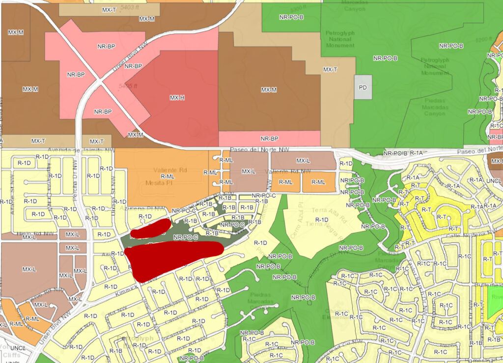
- the area around Unser and Paseo in pink is intended to be a city center. The long term vision many years ago was that it would be similar to uptown mall.
- dark brown labeled MX-M is moderate intensity mixed use. this can be anything from apartment buildings to stores. taller multistory buildings are allowed in these zones.
- light brown MX-L is low intensity mixed use. low density multi-family dwellings (condos/townhomes) and smaller convenient store like stores.
- yellow is strictly single family residential.
- orange R-ML is low density single or multi-family dwellings. no commercial would be allowed here.
- green is open space.
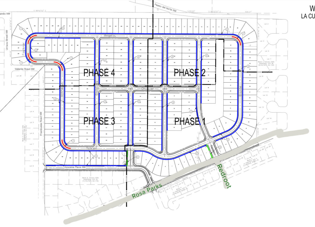
La Cuentista 3
So we already know that the large orange area directly north of our neighborhood is going to be La Cuentista 3. It will be around 200-300 lots (estimated) and will be single family homes only. La Cuentista 3 will have it’s own HOA similarly to La Cuentista 2.